Top alternatives to IGiS Desktop-Scanpoint Geomatics Limited


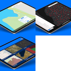
Touch GIS
No reviews yet
Is this a good alternative?
Data Collection & Mapping For The Mobile Era FEATURES - Intuitive Interface - Offline Capability - Map Caching - Robust File Support - Customizable Attribute Forms - Collect Point, Line, and Polygon Features - Custom Feature Classes - Feature Class Templates
Read More Read LessTop IGiS Desktop-Scanpoint Geomatics Limited Alternatives and Competitors
- Gis.XL - Online maps in Excel
- Touch GIS - Powerful mapping & field data collection for iPhone & iPad
- Top IGiS Desktop-Scanpoint Geomatics Limited alternatives are Gis.XL , Touch GIS , .
- IGiS Desktop-Scanpoint Geomatics Limited was listed under Web App .
- Web App - you know that place with all those cat pics and gifs? it also has some other neat stuff.
- Visit Tiny Alternatives for more updates about IGiS Desktop-Scanpoint Geomatics Limited alternatives.


